
Caption
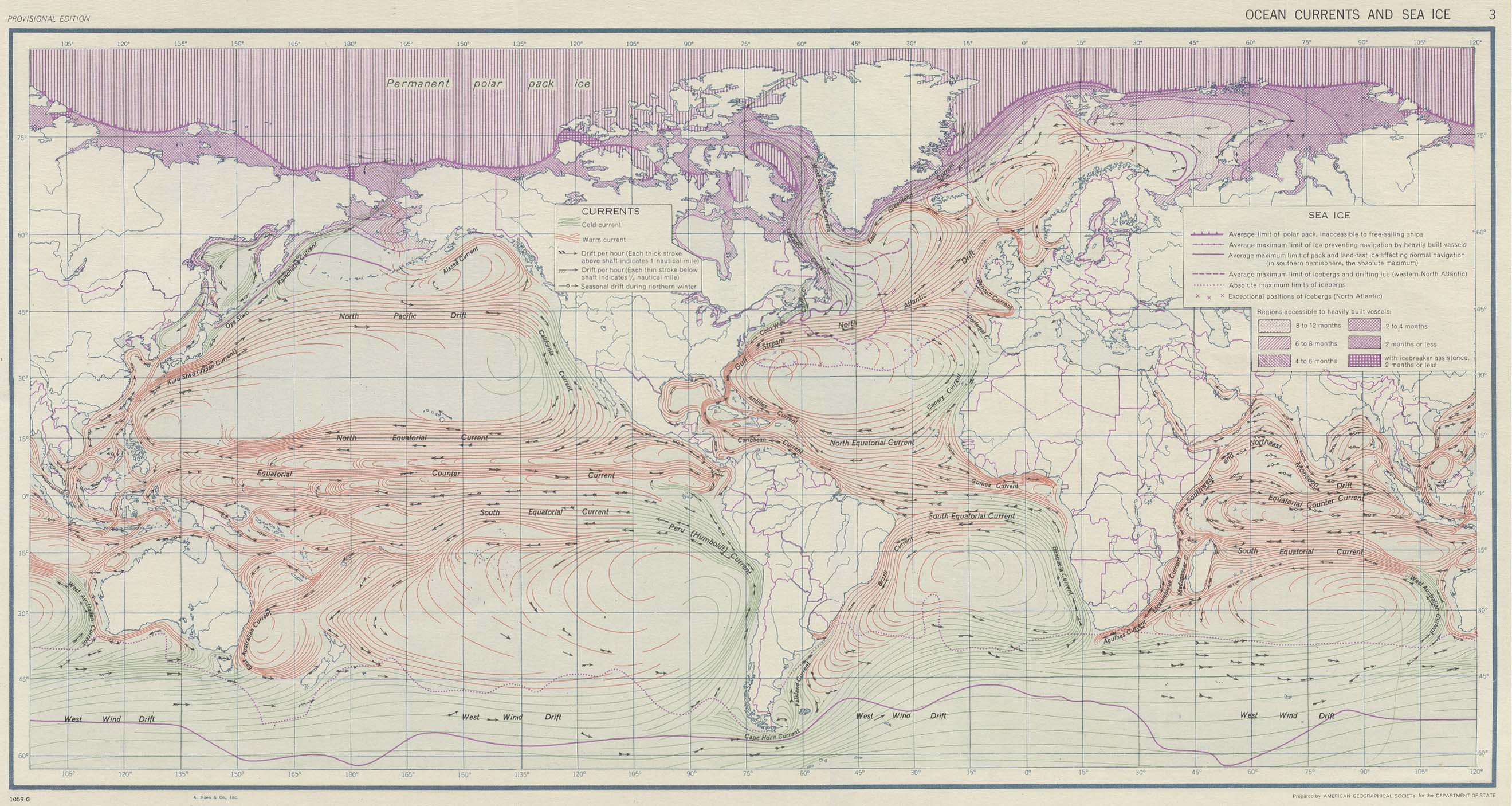
Ocean Currents and Sea Ice
Summary
This world map differentiates between cold and warm ocean currents,
and shows sea ice indicators such as:
- the average limit of the polar ice pack
- regions accessible to heavily built vessels
The map is marked “Provisional Edition”.
Source
Atlas of World Maps. United States Army Service Forces, Army Specialized Training Division.
Army Service Forces Manual M-101. 1943
Prepared by American Geographical Society for the Department of State.
Perry-Castañeda Library Map Collection [1]
![[1]](http://www.lib.utexas.edu/maps/world_maps/ocean_currents_1943.jpg)
Copyright
| |
This work is in the public domain in the United States because it is a work of the United States Federal Government under the terms of Title 17, Chapter 1, Section 105 of the United States Code. |
 |