
Caption
International Trade in the 4th and 3rd Millennia BC
Summary
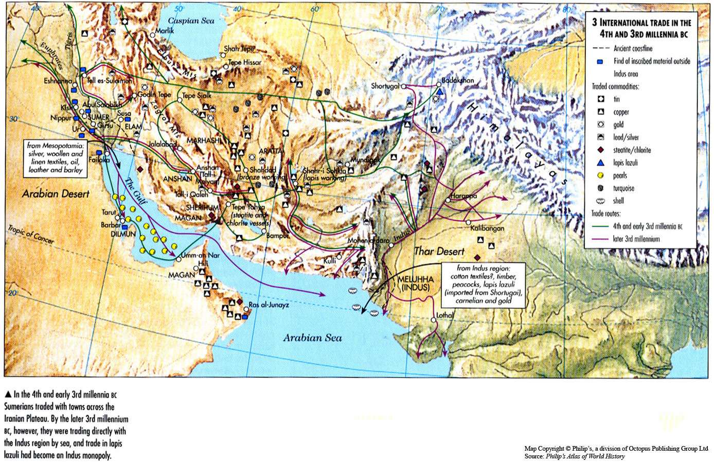
This map of the Middle East and southeast Asia indicates the trade routes the Sumerians had taken during the 4th and 3rd Millennia BCE.
It also shows the sites of key resources and traded commodities.
Source
Oxford Atlas of World History, Oxford University Press, 1999. General Editor Patrick K. O’Brien. (p. 29)
Copyright
Map copyright © Philip’s, a division of Octopus Publishing Group Ltd.
Source: Philip’s Atlas of World History
Used under license from Octopus Publishing Group.
Series
This map is one in a series of maps selected from the Oxford Atlas of World History.
A gallery using flyover images like this
[[Category:]]