
Caption
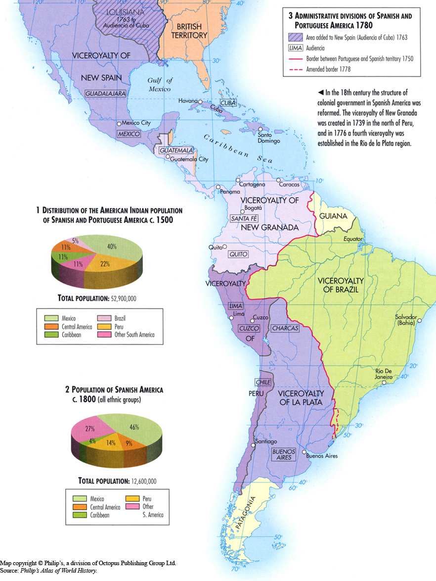
Administrative Divisions of Spanish and Portuguese America 1780
Summary
This map shows the administrative or political divisions of the colonial government in Spanish America in 1780.
Legend indicates:
- Area added to new Spain (Audiencia of Cuba) 1763
- Audiencia
- Border between Portuguese and Spanish territory 1750
- Amended border 1778
Two pie charts are also provided:
1. Distribution of the American Indian population of Spanish and Portuguese America c. 1500
2. Population of Spanish America c. 1800 (all ethnic groups)
Source
Oxford Atlas of World History, Oxford University Press, 2002. General Editor Patrick K. O’Brien.
Chapter 3. The Early Modern World: “The Colonization of Central and South America 1500-1780,” page 123.
Copyright
Map copyright © Philip’s, a division of Octopus Publishing Ltd. Source: Philip’s Atlas of World History.
Used under license from Octopus Publishing Group.
Series
This map is one in a series:
This map is one in a series of maps selected from the Oxford Atlas of World History.
A gallery using flyover images like this