
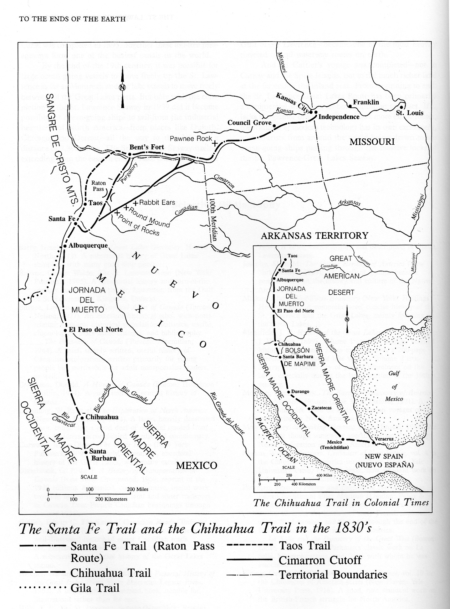
Caption
The Santa Fe Trail and the Chihuahua Trail in the 1830’s
Summary
Map Shows The Santa Fe and Chihuahua Trails in 1830’s, in addition to the Gila and the Taos Trails and the Cimarron Cutoff. An imprinted map shows the Chihuahua Trail in Colonial Times.
Source
To the Ends of the Earth: The Great Travel and Trade Routes of Human History (p. 362)
Facts on File Publications, New York and Oxford, 1984.
Copyright
Irene M. Franck and David M. Brownstone.
This is a copyrighted work. Its use on QED is under the “Fair Use” rule.