
Caption
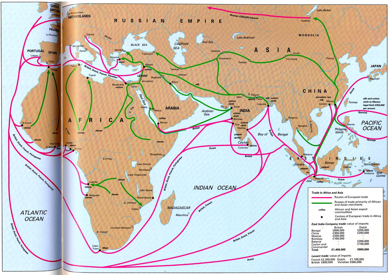
Trade in Africa and Asia
Summary
The map shows trade routes, goods traded, and amount of imports and exports between Europe, Africa, and Asia. Dates are unknown but is assumed to be between 15th and 18th centuries.
Source
Geoffrey Barraclough. Times Atlas of World History (p. 195).
Times Books Division of Harper Collins Publishers, London. 4th edition, 1993.
GIS Library. Scanned at 400dpi, digitized at 300dpi.
Copyright
Geoffrey Barraclough.
This is a copyrighted work. Its use on QED is under the “Fair Use” rule.