
Caption
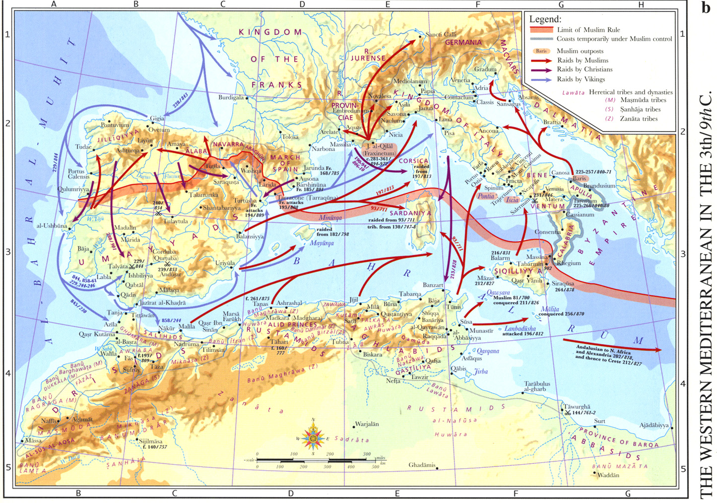
The Western Mediterranean in the 3rd-9th C.
Summary
This map illustrates the general conditions of the establishment of Muslim rule in Portugal and Spain. Existing medieval roads inherited from the Roman administration were used by the Umayyads to pursue their conquests. To penetrate Spain, they followed the main roads of Sevilla and Cordova in the South, and Merida and Toledo on the border.
Legend indicates:
- Limit of Muslim Rule
- Coasts temporarily under Muslim control
- Muslim outposts
- Raids by Muslims
- Raids by Christians
- Raids by Vikings
- Heretical tribes and dynasties
- Masmuda tribes
- Sanhaja tribes
- Zanata tribes
Source
An Historical Atlas of Islam – Atlas Historique de l’Islam, Second Edition. Edited by Hugh Kennedy, Tuta sub Aegide Pallas 1683,
Brill, Leiden-Boston-Koeln, 2002, page 53.
Cartography by Marc Bel, Peter van der Donck.
Copyright
© 2002 Koninklijke Brill NV, The Netherlands. All rights reserved.
Series
This map is one in a series:
- Image:MG©Environments and Mineral Resources of the Islamic World circa 390-1000.jpg
- Image:MG©Al-Andalus and Al-Maghrib- The Muslim Conquest, 44-732.jpg
- Image:MG©Islam in China, 9th-20th Centuries.jpg
- Image:MG©Linguistic Regions of the Islamic World circa 900-1500.jpg
- Image:MG©Ottoman Expansion 1362-1402 A.D. The First Conquest of Rumelia and Anatolia.jpg
- Image:MG©The Indian Ocean circa 390-1000.jpg
- Image:MG©The Muslim World circa 403-1100.jpg
- Image:MG©The Muslim World circa 700-1300.jpg
- Image:MG©The Muslim World circa 905-1500.jpg
- Image:MG©The Muslim World circa 1111-1700.jpg
- Image:MG©The Muslim World circa 1317-1900.jpg
- Image:MG©The Turks and Portuguese in the Indian Ocean 10th-16th Centuries.jpg
- Image:MG©The Western Mediterranean in the 3rd-9th C..jpg
- Image:MG©The World on the Eve of the Muslim Conquests circa 600 A.D..jpg
- Image:MG©The World According to Al-Idrisi 549-1154.jpg
- Image:MG©The World According to Al-Sharfi 986-1579.jpg