
Caption
The Diffusion of Cholera in the United States in 1866
Summary
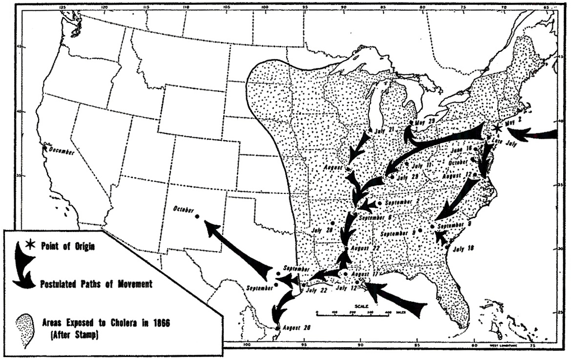
This map depicts “the diffusion of cholera in the United States in 1866 showing the
growing effect of the maturing transport system (river, rail, and sail) on the diffusion of this disease compared to the 1832 epidemic.” (Koch, p. 259)
In 1832, cholera typically entered the U.S. from northeastern seaports and from Canada, and then traveled down the east coast or west along the Erie Canal and then down the Mississippi. By 1866, New Orleans was also a point of entry, and the disease traveled by both rail and river systems along the lines of the transportation network linking major cities.
Source
The image was scanned from Fig 10.6 in Tom Koch (2005). Cartographies of Disease. ESRI Press, Redlands, California.
The image was published in Pyle, G.F (1969). “The Diffusion of Cholera in the United States in the Nineteenth Century.” Geographic Analysis 1 (1): 59-75.
Copyright status
Copyright © 1969 by the Ohio State University Press.
All rights reserved
Collection
|
Transmission Routes of Cholera (1817-1831) |
 The Progress of the Spasmodic Cholera, 1832 |
 United States Cholera Route – Epidemic of 1832 |
 Broad Street Outbreak of Cholera, London, 1854 |
 The Geographical Distribution of Health and Disease, 1856 |
 The March of Cholera in 1865 |
 The Diffusion of Cholera in the United States in 1866 |
 Diffusion of Cholera in Eastern Africa, 1864-1871 |
 Cholera Diffusion in Zanzibar c. 1869 |
 Historical cholera pathways in 1817-1823 and 1863-1869 |
 Routes of Asiatic Cholera (1885) |
 Network of cholera diffusion in India, c1931-1953 |
 Cholera, 2000-2001 |
 Cholera, 2003 |