
Caption
The Church at the Time of Constantine
Summary
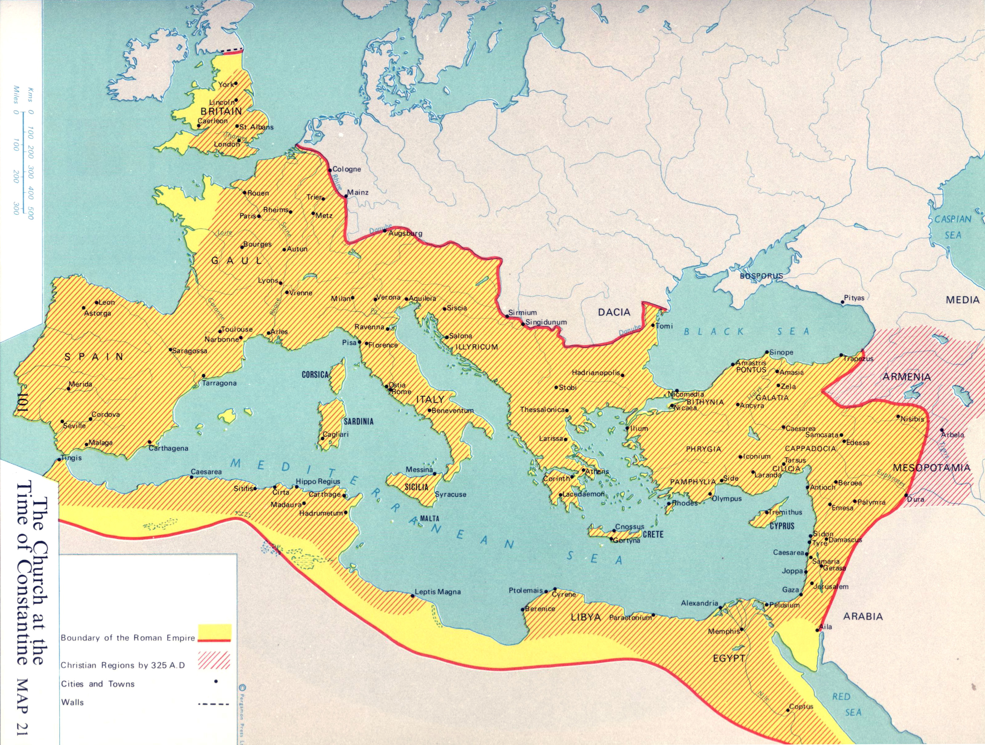
Map shows the extent of the Roman empire, Christian territories, and major cities, towns, and walls by 325 A.D.
This is a copyrighted work. Its use on QED is under the “Fair Use” rule..
Source
Atlas of Man and Religion (p. 101)
By Gordon K. Hawes, The Religious Education Press, a member of the Pergamon Group, Oxford, 1970. Layout and maps by Stanley Knight R. R. G. S.
Copyright
© 1970 Gordon K. Hawes & Stanley Knight