
Caption
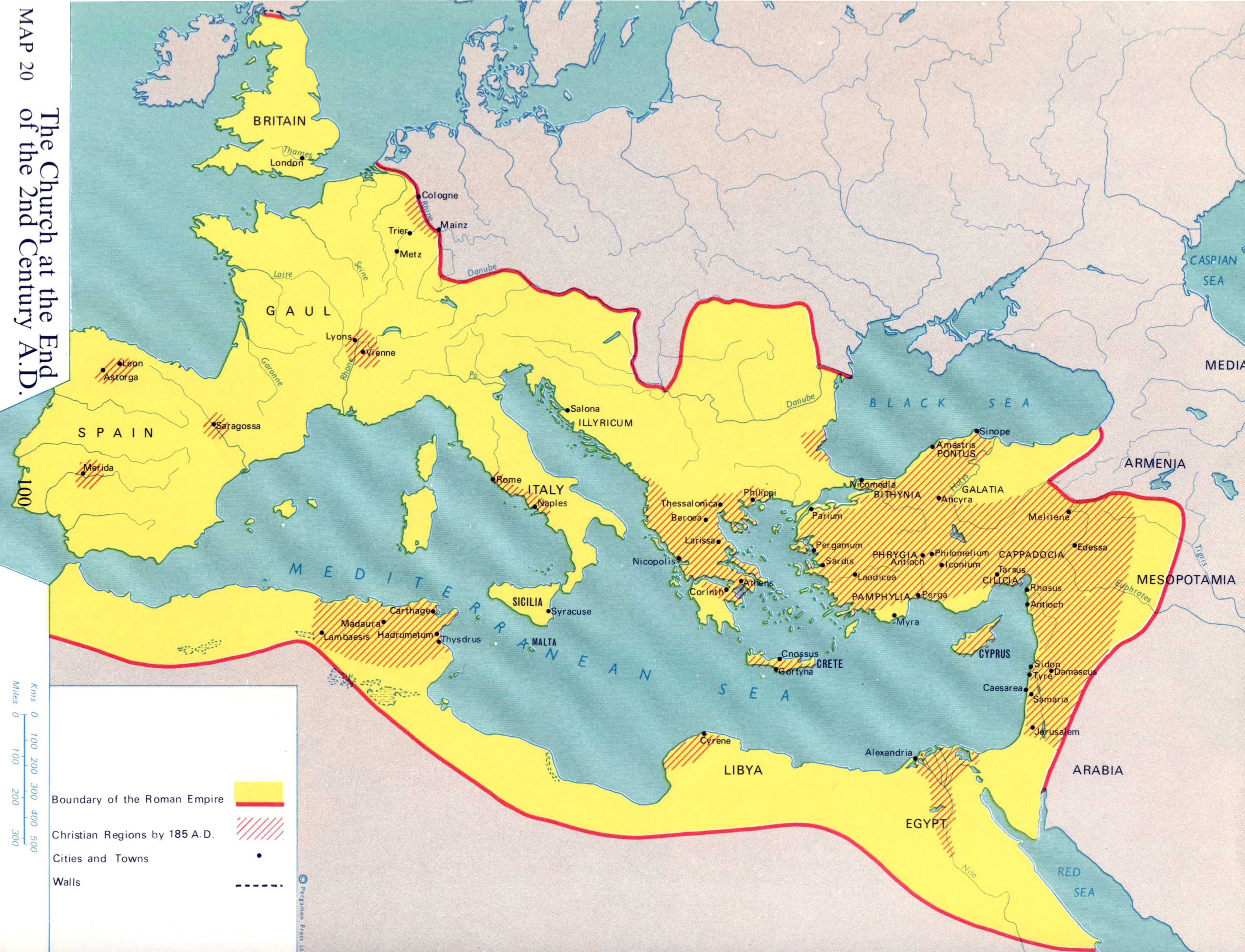
The Church at the End of the 2nd Century A.D.
Summary
Map shows the extent of the Roman empire, Christian territories, and major cities, towns, and walls by 185 A.D.
This is a copyrighted work. Its use on QED is under the “Fair Use” rule..
Source
Atlas of Man and Religion (p. 100)
By Gordon K. Hawes, The Religious Education Press, a member of the Pergamon Group, Oxford, 1970. Layout and maps by Stanley Knight R. R. G. S.
Copyright
© 1970 Gordon K. Hawes & Stanley Knight