
Caption
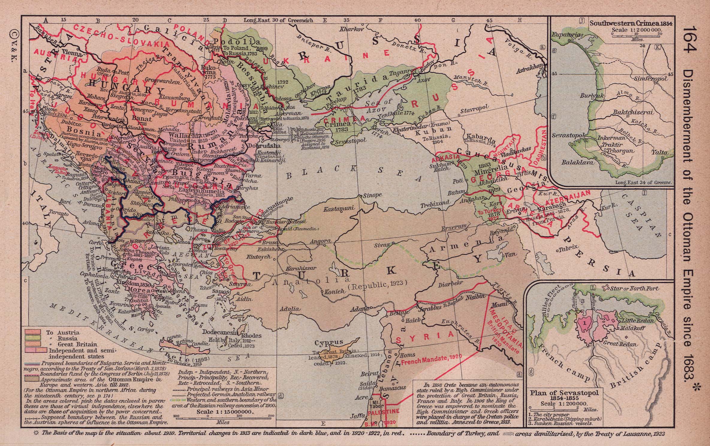
Dismemberment of the Ottoman Empire since 1683
Summary
This map shows the distribution of the Ottoman Empire after its dismemberment, with later nation boundaries stamped on the map in red after its 1923 publication date. Also showing areas demilitarized by the Treaty of Lausanne, 1923. Insets: Plan of Sevastopol 1854-1855; Southwestern Crimea 1854.
Source
Perry-Castañeda Library: Map Collection: Historical Atlas by William R. Shepherd [1] [2]
![[2]](http://www.lib.utexas.edu/maps/historical/ottoman1683_shepherd.jpg)
“Historical Atlas” by William R. Shepherd, New York, Henry Holt and Company, 1923
Copyright
Public domain