
Caption
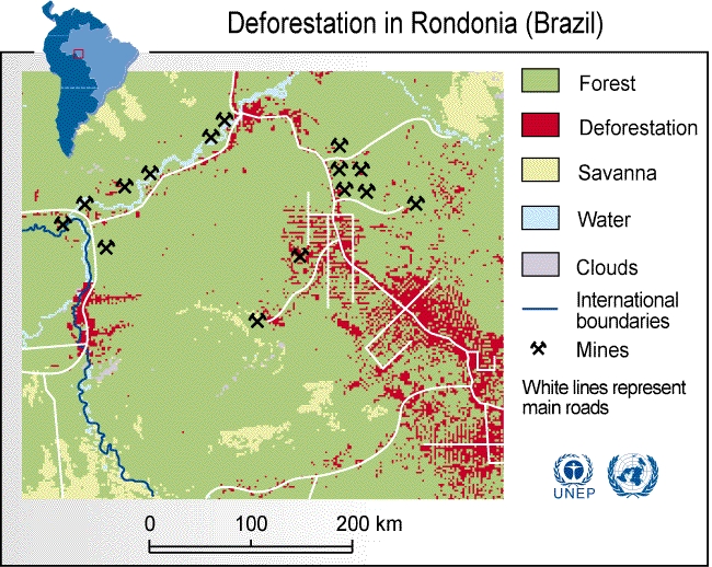
Deforestation of Rondonia, Brazil since 1980
Summary
This map shows the increasing deforestation occurring in Brazil since 1980.
Though Brazil makes up one quarter of the world’s forest, its forests are in decline as a result of agricultural processes, construction of new towns and commercial logging.
Source
United Nations Environment Programme / GRID-Arendal[1]
Cartographer/Designer: Philippe Rekacewicz, UNEP/GRID-Arendal
Copyright
© 2006 UNEP / GRID-Arendal
Licensing
For use constraints, see [2].
Series
This map is one in a series For a listing with flyovers, see Series:UNEP / GRID-Arendal.