
Caption
Indian Ocean 1800-1900
Summary
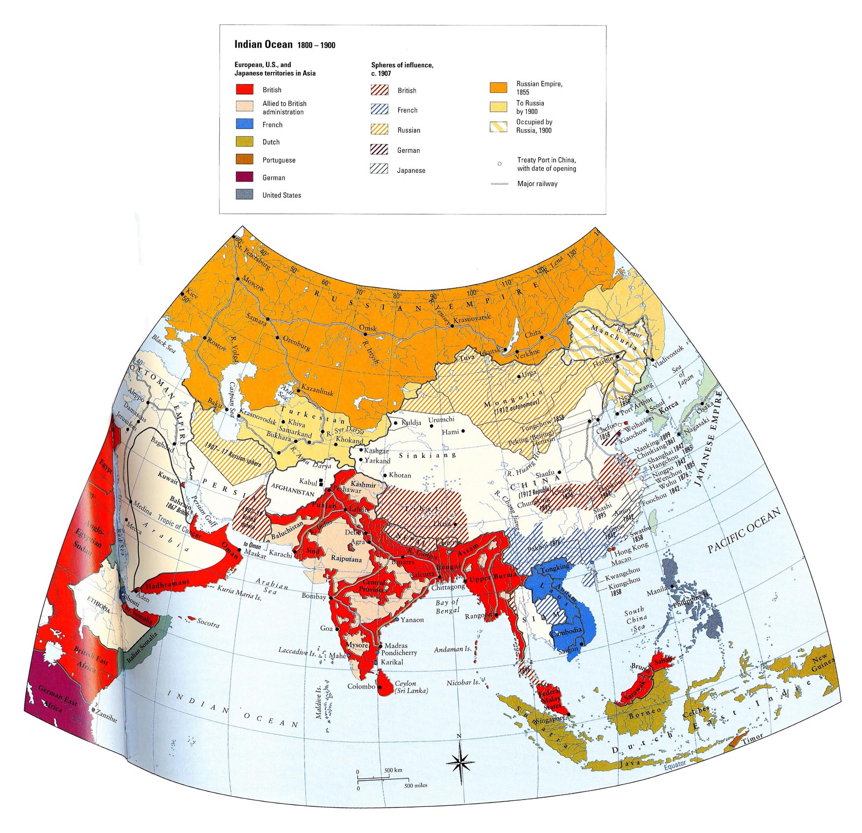
This map shows the territorial holdings of Britain, France, the Netherlands, Portugal, Germany, and the United States in the Indian Ocean region from 1800-1900. The spheres of influence of the British, French, Russian, German, and Japanese empires in 1907 are also depicted. Major railways are indicated.
Source
Historical Atlas of the Islamic World (p. 83)
Copyright
Copyright © Oxford University Press, 2004
License
This map is used on this website by permission of Oxford University Press.
The license only allows it to be used in connection with SOC284 and WWS572B at Princeton University during the 2008-9 academic year.
The map appears in Malise Ruthven and Azim Nanji, Historical Atlas of the Islamic World (Oxford University Press, 2004).