
Caption
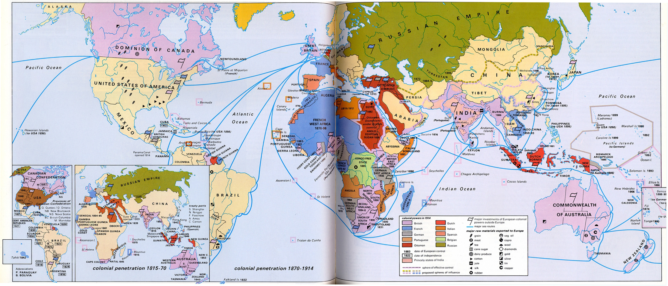
Colonial Penetration, 1815 – 1914
Summary
The map shows worldwide French, Dutch, Ottoman, British, German, Portuguese, Italian, Spanish, Belgian, and Russian colonial empires and influence from the 19th to 20th centuries, with raw exports and sea routes from the colonies.
Source
Geoffrey Barraclough. Times Atlas of World History (p. 241).
Times Books Division of Harper Collins Publishers, London. 4th edition, 1993.
GIS Library. Scanned at 400dpi, digitized at 300dpi.
Copyright
Geoffrey Barraclough.
This is a copyrighted work. Its use on QED is under the “Fair Use” rule.