
Caption
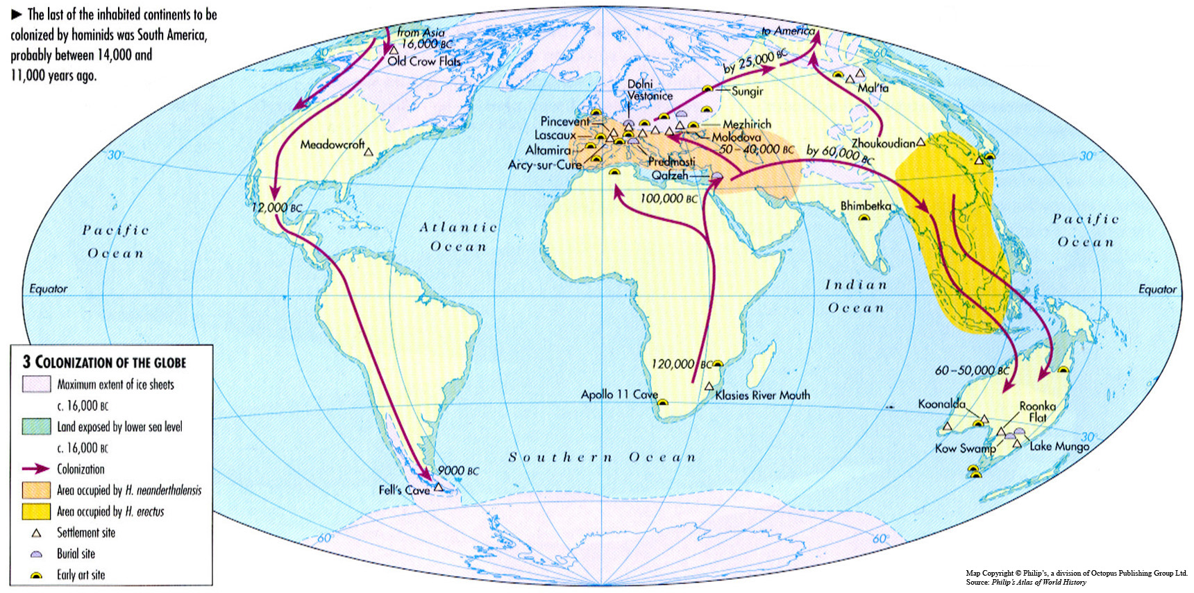
Colonization of the Globe c. 120,000-9,000
Summary
This map shows the colonization route that originated in Africa and followed several paths through Europe and Asia to end in South America approximately 9,000 BC.
Legend indicates:
- Maximum extent of ice sheets c. 16,000 BC
- Land exposed by lower sea level c. 16,000 BC
- Colonization
- Area occupied by H. neanderthalensis
- Area occupied by H. erectus
- Settlement site
- Burial site
- Early art site
Source
Oxford Atlas of World History, Oxford University Press, 2002. General Editor Patrick K. O’Brien.
Chapter 1. The Ancient World: “The Human Revolution: 5 Million Years Ago to 10,000 BC,” page 16.
Copyright
Map copyright © Philip’s, a division of Octopus Publishing Ltd. Source: Philip’s Atlas of World History.
Used under license from Octopus Publishing Group.
Series
This map is one in a series:
This map is one in a series of maps selected from the Oxford Atlas of World History.
A gallery using flyover images like this