The area around Bridewell brings together people from all walks of life as one might expect from a place with a garden, two prisons, multiple churches, countless wharves, and a royal history. In addition, the small houses cramped together in the spaces left in between the various institutions suggests that the area was probably relatively densely populated. This makes sense as everyone might have a different reason for living there.
“A Whistling Shop. Tom & Jerry visiting Logic ‘on board the Fleet'” from Pierce Egan’s Life in London (1821)
Someone could be in Fleet Prison because they are in debt; another might be working at the prison. The drawing of the inside of a whistling shop from Egan’s Life in London shows the range of people who are living here. Within the same room, there is a man in tattered clothes warming himself by the fire, a woman with children, some card players, and almost everyone is drinking. The clothes of the people—especially the colours and cuts of their clothing, and the types of hats they are wearing—implies that most of these people are not from the same socioeconomic class; however, it is also clear that no one is from the upper-upper class, and there are very few from the lower-upper class, if indeed there are any. How much would things have changed in, say, fifteen years from the time this drawing was made in 1821?
Charles Dickens could help us see that the answer is not that much. In his earliest novel, The Pickwick Papers, Mr. Pickwick ends up in Fleet Prison, and Dickens’s description wouldn’t appear strange to someone familiar with the prison from Horwood’s Plan.
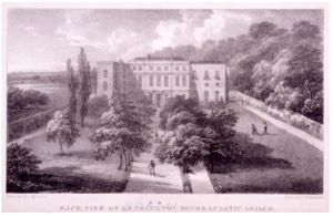
Charlotte Brontë references another prison in this area during a game of charades in Jane Eyre: Bridewell. This prison starts off as a Tudor palace and is later converted into a hospital and prison during the reign of Edward VI. While the purpose of this building has changed over time, the various structures surrounding Bridewell are a reminder of its history through names like King Edward Street, St. Bride’s Church Yard, St. Bride’s Wharf, Crown Court, Tudor Street, Bride Lane, Bride Court…
“Poor Sweep, Blackfriars Bridge” from Mapping Modern London (1804)
Bridewell during the late 18th and early 19th century has significantly changed since its days as a royal palace. The Pass-Room from Ackermann’s Microcosm of London shows a Bridewell where women are sleeping on hay because there are not enough beds. It is probable that some of these women are single mothers since there are children in the middle of the drawing.
In addition to the prisons and people who live in the area because they are in some way connected to the prison system, another demographic to keep in mind is children working to survive. We see Blackfriars Bridge as a spot where crossing sweepers work in Modern London. This suggests there are also middle class people who are coming in and out of this part of the City of London since someone must be paying for this service provided by children. Bridewell and its surroundings is a point of entry into the district, and therefore it makes sense that the place be populous and host people from different socioeconomic backgrounds.
“Poor Sweep, Blackfriars Bridge” from Mapping Modern London (1804)
The seam joining the Thames with the rest of the City of London is the wharves: just within the area surrounding Bridewell there are over fifteen of varying sizes. This abundance makes sense with the context given in Fores’s list that London harbours over ten thousand boats. As a result, however, the boundary between the natural and built environment is blurred even more than it already was; after all, where does the river end and the district begin if the boats are part of the city?
Blackfriars Bridge as depicted in Malton’s Picturesque Tour (1792-1801)
The natural environment—most notably the Thames—influences the built environment both in terms of the types of structures that need to exist to make this district the heart of the larger city, and in terms of the names of these structures. In addition to the wharves, a point of contact between this part of the City of London and the river is Blackfriars Bridge. Without the bridge and the wharves, not only would access to the area be far more limited, but this shift away from being a hub would fundamentally change the area’s identity since multiple structures have names referring to this symbiotic relationship between the natural and the built. The two most prominent streets that connect other smaller streets together are aptly named Fleet Street and New Bridge Street. The prison located right next to the intersection of these streets is also called Fleet Prison. There are numerous other smaller streets that highlight this Thames-based identity such as Little Bridge Street and Water Street.
Another important meeting point between the natural and the built environments is the Temple Gardens. The natural body of water directly next to the garden plays into the style of English gardens that contrasted from the jardin à la française. As can be seen in the image of Temple Gardens from 1809, the artificially created nature is still meant to look realistic to an extent. This is a heightened form of nature, but is, nonetheless, reminiscent of undisturbed nature. There is a deliberate attempt to work with nature—unlike the symmetrical and perfectly trimmed topiary common in French gardens—that makes this garden stand out as quintessentially English.
Bridge Street, Blackfriars from Papworth’s Select Views (1816)
When we look at changes between Horwood’s Plan and Faden’s 1819 revision, we see there is a new and much smaller garden that is built right next to Bridewell. In addition to the garden, Bridewell also has a new chapel in its premises. Another change is the obelisk located in the intersection between Fleet Street and New Bridge Street. The obelisk must have been there since 1816 at the latest given the image of Bridge Street from Papworth’s Select Views includes the obelisk. The most substantial change in the area that alludes to technological developments of the time is the replacement of the New River Office and Yard with the Gas Light Company. The existence of the company suggests that using gas light must have been popular enough to sustain a business as early as 1819.
Bridewell Hospital and surrounding area in Horwood’s Plan (1792-9)Bridewell Hospital and surrounding area in Faden’s 1819 revision. Orange highlights refer to places that have changed since Horwood’s original map. Green highlights refer to places mentioned in the current and following posts that have not changed between the two editions of the map.
It’s the dawn of the 19th-century and we’re in London’s Greenwich District.
The population stands at 32,621. Our district has only one hospital, Royal Seamens, which cares for our disabled sailors. A decade into the century, the population grows to 36,780—an increase of 12.75 percent. No new institutions appear in this period. Another decade passes and the population is now 41,530. This is an increase of yet another 12.91 percent. The population growth in the two decades has remained the same—we’ve had a total of 27.21 percent increase in population since the turn of the century. The numbers are rising yes, but this is not substantial enough to lead to subsequent growth in the institutions in the district. We need another factor for a more significant change to occur. This comes in 1834, when the new Poor Law, which requires children to be housed in exchange for work, is passed in London. But our district has to wait a bit longer—six years, to be exact. In 1840, the Greenwich Poor Law Workhouse appeared.
Between 1841-1850, the population rose to 55,212. This entails an increase of 32.94 percent from the previous decade and an increase of 69.25 percent since the beginning of the century. The appearance of the workhouse has impacted the growth of our district in this short period—in fact, we can speculate that the workhouse might be responsible for a 20.11 percent rise in the population. But we’ve to speed later into the century for a full glimpse of the true impact of the workhouse.
Boom! We’re now at the tail end of the century. The population in Greenwich District is 131,233 people. This is an increase of 302.3 percent since the turn of the century. But we want to know what caused the population growth. In just the last half of the century, the population has risen 137.69 percent. In the first half, as you may remember, we’d a growth of only 69.25 percent. The difference is more than double. This means the workhouse has significantly increased the population of Greenwich District.
The suggestion of our data is clear. The workhouse has recruited a lot of children, many of whom had traveled from outside our district. In 1875, another workhouse had to be built to accommodate more inmates. Perhaps due to the poor conditions at the workhouses, St. John’s Hospital was built in the district. Where we’d had a hospital for seamen previously, we now have two missions — our district now caters to the spirituality of the seamen, which signifies the growth of the church in the late 19th-century.
From the experience of our district, we glean a trend, which may extend to the rest of the city. The introduction of the new Poor Law in 1834 led to the emergence of the workhouses, which were a magnet for inmates. This subsequently led to the growth of the population in the areas where the workhouses were located.
***
Up until now, we’ve gotten the impression that the upsurge in Greenwich’s population was entirely due to the workhouses, but this may not be true. Other sites in our district have also played a role in attracting residents from around the city and perhaps even the world. Greenwich was home to the Royal Observatory, which, as the image below indicates, was a popular attraction. It was located in a park, which turned into a site for social gatherings. The district was also home to astronomers from around the world. As the population grew and industry flourished, scientific discoveries began to be made. Time was measured; new maps were made and the stars and planets explored—this was Greenwich, after all. All these factors contributed to the expansion of the district and the rise of the population.
Greenwich Park, with the Royal Observatory, on Easter Monday, from Modern London.
But we’re getting ahead of ourselves.
You may be asking how these factors were interconnected. Well, let’s consider trade, which perhaps provided the most important impetus for Greenwitch’s growth. Our district housed the West India Docks, which facilitated the import and export of goods. This brought free raw materials and labor. The docks were surrounded by warehouses, which made it easier to load and reload goods, shortening the amount of time it took. This design was efficient and it was replicated all across the city, leading to the growth of the shipping industry. There was also the East India Company in our district, which was established in 1803 and even preceded the West India Docks, and it brought goods and labor all the way from India. We can imagine some of the workers must have settled in Greenwich. We can also speculate that traders moved from other parts of the city to be closer to the docks. This created an interconnected web, which linked our district to other parts of the city and the outside world all at equal measure— it was the net of capital, it was the pace of the 19th-century.
The hospital was located just across from the docks, which perhaps was meant to control the outbreak of diseases.
The West India Docks in the Isle of Dogs with Greenwich Hospital in the Foreground.
As we can see in the image below, the Empire was beginning to take shape. From the docks, the goods were sent to the warehouses and the people to the hospital. And the first part of the cycle was complete.
Greenwich Hospital, from Black’s guide to London and its environs.
***
The second part of the cycle of capital involves selling. To understand this better, we need to draw closer, right into a street in Victorian London.
This is the view from your street.
It’s past noon. You’ve reached High Street, which houses your business. The carriage creaks to a halt.
Just as you’re stepping out, the driver leans in and whispers, “Sir, your hair.”
You don’t catch the rest of what he says, but you decide you must get a haircut today and go straight into the barber.
Just like yesterday, there’s another man in the line and you’re asked to stand by. Stepping out of the shop and into the chair outside, you fish out a book from your coat and begin reading.
Crank, crank! The noise is too distracting. Craning your neck for a look, you notice a glass cutter has taken up the shop on the second floor of the building. The landlord was looking for someone to rent it.
You begin to wonder why the carriages still haven’t arrived today. When you draw out your watch from your coat pocket, you notice it’s broken. You decide to take it to the watchmaker, who says you’ll be waiting for three days for it to be fixed. This is too long.
Annoyed, you step into the street.
In distance, the carriages you were waiting for are approaching. They’re carrying garments you had ordered weeks ago. You now head to your shop to open the store.
“Sir, sir,” you hear from behind you, “it’s your turn.”
This is the barber’s voice. You pretend you haven’t heard him and fasten your pace. You run into men unloading china and a whole package of plates falls down and crushes. The china dealer is dismayed, but once he notices you’re the owner of the cloth mart, he calms down, comforted by the fact that you’ll be able to pay for the broken plates. The hosier and fringe manufacturer across from your building has also received the hosiery she had ordered and you’re worried about the competition. As you open your store, a waft of tobacco fills the air. It must be from the tobacco dealer’s direction. From your window, you catch a young boy stealthily walking out of the gold seller’s and breaking into a run. The men on the street take after him.
“I must return to 2021,” you think. But for now, you must remain a cloth dealer in 19th-century London.
Since there were no “Tallis Street Views” pertaining to the Kensington Vestry, I decided to select the following view of Oxford Street near Hyde Park near the intersection with Park Lane as a source of examination:
Tallis Street View of Oxford Street near Hyde Park near the intersection with Park Lane.
There are many terrace buildings in this section of Oxford Street, suggesting it is a hustling and bustling locale. However, in this part of the street there doesn’t seem to be quite as many businesses as further down, suggesting that perhaps this was the bridge between a more residential and commercial area. The proximity to Hyde Park suggests that this was a sort of “in-between” space, connecting the busy hubbub of one of the major streets of the city to the natural, less crowded park space. The side of the street pictured above is filled with tall buildings of an even height, while the opposite side of the street shows buildings that were more uneven. On this side of the street a boot-makers shop can be seen – the first building in a string of stores that continue well down Oxford Street.
I imagine that the smell of greenery would waft from the park over to this part of the street and would provide a sort of floral scent for people passing up and down. I would hear carriages as they traverse the street and exit in and out of the park. Wheels would turn over gravel-paved roads and I would hear the sound of horses trotting and snorting as they carried passengers to and fro. The sound of voices would fill the air as citizens converse as they walked up and down the street and wandered in and out of stores.
Bethlehem Hospital from The Queen’s London: a pictorial and descriptive record.
Not far from this location lay the Bethlehem Hospital. This hospital existed in various forms as early as 1247 but opened at its St. George Fields location in 1807, after its former premises were deemed unsafe. It was originally built for a capacity for 200, although some extensions were made during the century to accommodate up to 400 patients. Criminal patients were moved to Broadmoor in 1864. In 1930 it moved to its current site in Kent. It is the oldest psychiatric institution in the world. The nineteenth-century premises are now the Imperial War Museum.
The premises of Bethlehem Hospital are grand and imperial. The gates cast an ominous ambience over the establishment, while the extensive fencing and hedging reinforces the hospital’s desire to keep patients in and the general public out. The building itself is imposing, its image of grandeur projected mainly through its Ionic columns and large dome. A passer-by may have a sense of wariness as they walked past this hospital, marvelling at the architectural magnificence of the building whilst simultaneously becoming unnerved by the knowledge of its purpose as an asylum for the insane.
Throughout the 19th century, the population growth in the Kensington District area was substantial. This presumably occurred due to the westward urban sprawl of the city, seeing inhabitants move out of the city centre and towards the outskirts. In the 1800s, the population was recorded at 8,556, yet by the 1890s the population had reached 163,151. This demonstrates a population rise of 1900% over a period of 90 years. Interestingly, Kensington is also significantly more populated than the surrounding metropolitan districts. This may suggest something about the social class of Kensington during this time – perhaps it was more affordable than the neighbouring Westminster and Chelsea vestries. At the beginning of the century Kensington was largely dominated by market gardens with large estates, meaning population density was low. However, beginning in the 1860s there was an infrastructural boom. In 1867 and 1868 construction in the Kensington district alone accounted for 10 percent of all building erections in London. Large properties were also subdivided during this time, increasing population density by creating room for a greater number of people to settle and minimising the number of families living on large estates.
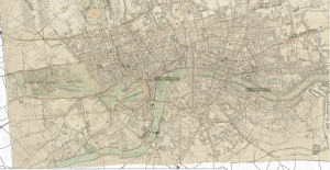
View of Cary’s new and accurate plan of London and Westminster, the borough of Southwark and parts adjacent; viz. Kensington, Chelsea, Islington, Hackney, Walworth, Newington, &c….and plans of the New London & East and North India docks (1818).
I also consulted some historic basemaps in order to get a better understanding of how the population density of the area changed over time. An 1818 map, Cary’s new and accurate plan of London and Westminster, the borough of Southwark and parts adjacent; viz. Kensington, Chelsea, Islington, Hackney, Walworth, Newington, &c….and plans of the New London & East and North India docks, reveals the Kensington district to have been relatively underdeveloped and rural during the 1810s.
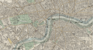
View of the Stanford’s map of the British metropolis and its suburbs (Published by Edward Stanford, 1884).
From this basemap, it appears that the area is dominated by large-sized parks, paddocks and grounds attached to expansive properties. However, the Stanford’s map of the British metropolis and its suburbs (Published by Edward Stanford) demonstrates that by 1884, Kensington was far more developed. You can even see a railway running through the area. I imagine this would have increased accessibility to the Kensington district and attracted more individuals looking to settle down among the outskirts of London. This may also explain why Kensington was more populated at the end of century than its neighbour Fulham – perhaps the railways did not stretch that far at that point.
The metropolitan work district I have chosen to focus on for this project is the Kensington district. At the beginning of the nineteenth century, the only institution within the Kensington district was the Fulham Road Workhouse, which was expanded in 1876 when the infirmary was extended. It is currently occupied by Chelsea and Westminster Hospital. In the 1840s another workhouse appeared in the district called the Marloes Road Workhouse. This workhouse expanded its premises in 1880 by incorporating two other workhouses on the same road – the former St. John’s Westminster and St. Margaret workhouses. After its expansion, this institution housed 730 inmates and 470 sick and injured individuals in the infirmary.
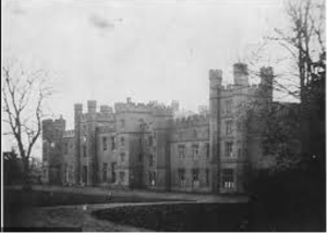
Throughout the 1820s and 1830s two lunatic asylums appeared in the Kensington district. The first was Cowper House, which housed nearly 40 patients in 1844, and the second was Kensington House Asylum institution housing 55 patients during the same time period. Both were private institutions, meaning they were profitable. This growth reflected a trend in this period where lunatic asylums offered a quick solution for the wealthy to send away “troubled relatives”. The profitability of these institutions is noticeable in their images. The grounds around the buildings are well manicured and extremely green. The buildings themselves look grand, lofty and imposing – indicative of the social class of their targeted demographic.
Cowper House housed 39 patients in 1844. It is situated on the south side of the street, roughly where Melton Court is today.
Also notable is the increase in hospitals from the 1840s onwards. The first hospital that appeared was the Hospital for Consumption and Diseases of The Chest, followed by the Cancer Hospital during the 1950s. The second was a hospital founded by William Marsden, offering treatment to poor cancer patients for free. The final hospital to appear in this district was the Chelsea Hospital for Women during the 1970s, which exclusively treated diseases unique to women. Notable is the fact that these three hospitals all appeared along or close to Fulham Road, which may have had something to do with accessibility of these areas.
Kensington House is a private lunatic asylum. It accommodated 55 patients in 1844.
In the 1860s another medical-related charitable institution emerged – the Jews Deaf and Dumb Institution. This institution was situated in various other locations before settling in Notting Hill in 1875. This is particularly interesting as it was a leading institution in teaching the deaf through the method of oral learning. At roughly the same time, London’s oldest synagogue was also established, suggesting that there was a growing Jewish Community in the North Kensington area.
Background Investigation: Reagents Park is an important and central feature of St. Marylebone Vestry. While the park did not open to the public until the 1840’s, it was still a beautiful reprieve from the hustle and bustle of London City. In 1840, the park was opened 2 days a week to the public and hosted the London Zoo from 1847 which became a major tourist attraction in Victorian London.
The Zoo in Regent’s Park.
Your perspective: It is a beautiful summer day in 1843 and I’m planning on taking my kids to Regents Park to enjoy the summer air and see the new Elephants that Queen Victoria bought for the Zoo! I live in an apartment on Wigmore Street which is just one street over from the bustling Oxford Street, so on nice days such as today I can hear the faint commotion of street carriages and street sellers starting as early as the sunrise! Wigmore Street has all of the things I could want – there is the Knight Baker right across the street from me, a Linen and Outfitting warehouse, and G. Robinson’s Auctioneer studio for when my husband gives me a few extra shillings to spend. Another exciting location on Wigmore is The Royal Polytechnic Institute, which opened up in 1838 at the end of our street! It has brought in a lot of tourists from other boroughs to our neighborhood and has provided the public with so many innovative displays of England’s scientific discoveries. Our location is convenient for the children as well as it is just about a kilometer and a half walk to Regent’s Park.
The commotion of Oxford Street on full display.
Background investigation: Based on the Victorian London interactive map, the events hosted throughout St. Marylebone Vestry make the area appear as though it was relatively wealthy. When looking of a drawn map of the area around Wigmore Street and Baker Street, one can see numerous small block gardens, which are another indicator that those living in the area were on the wealthier side. In modern London, Marylebone is a “posh, wealthy borough that has a chic residential feel” according to London’s Financial Times.
A picture of modern day Marylebone – a “chic, residential neighborhood in London city”.
Your Perspective: As I walk the kids down Baker Street on our way to Regent’s Park, we pass the beautiful garden in Portman Square. While we appreciate our apartment on Wigmore Street, some of the houses here are much grander than our living space. We pass Portman Chapel a little farther up the street as we continue on our way. I love admiring the ladies beautiful summer frocks who pass by us on our walk I feel grateful that we live far enough from the city center to be able to walk around in fancier clothing without worrying about ruining our garments.
St. Marylebone Vestry had one of the highest population density boroughs between 1801 and 1810 with a population size of 63982. St. Marylebone Vestry remained one of the most inhabited boroughs in London throughout most of the 1800’s. The population saw a large increase in the years between 1810 and 1841 as it jumped to 138164, an almost 216% increase. The population increased yet again in the latter half of the 19thcentury when the population in Marylebone rose to 159254, another 115% increase from the original demographic. Interestingly, between 1871 and 1880 Marylebone’s population saw a decrease for the first time in a century transitioning from the 159254 in 1871 to 154910 in 1881.
There are two possible explanations for the decrease in population size. The first is that there was a surge in the quantity of hospitals, orphanages, and charitable organizations in the borough, which would have brought in a larger population of poorer individuals to an area that had previously had very few of these organization up until the late 1860s. The second explanation could be that Marylebone’s Vestry was on the outskirts of London and would have been an easy location for those traveling into the city to settle in to. As time progressed and more of these external boroughs became more developed, it is possible that some of the inhabitants of the area decided to move to other nearby boroughs such as St. Pancras Vestry, Paddington Vestry, and Hampstead Vestry which all saw population increases in the 1880’s.
It is interesting to note that St. Marylebone Vestry is relatively large geographically in comparison to many of the surrounding boroughs. It extends from the border of London to deep into the heart of the city. This proximity to the City of London (just a three mile walk as seen on the modern map of London) would make Marylebone an attractive location for individuals or families who would want to work but not live in the industrial section of the city. Also noteworthy is the fact that Marylebone Vestry remains heavily populated until the end of the 19tth century while almost all other districts near the heart of London become noticeably less populated every decade. I believe that Marylebone’s larger size and geographical proximity to both the countryside and City of London would lend themselves to a larger sustained population size.
Walking Distance from Marylebone to the City of London center.
At the beginning of the 19thcentury, there were very few institutions in St. Marylebone Vestry; the primary institutes in the borough were hospitals and orphanages. There was very little change in the quantity and diversity of establishments in Marylebone up until the 1830’s when the Marylebone Workhouse and London Society for Teaching the Blind were created. Yet, the the overwhelming majority of establishments in the borough continued to be hospitals and other charitable institutions. It was only in the 1860s and 70s that the number of businesses and organizations grew in numbers, which is consistent with most of the other boroughs outside the center city of London.
A business that was particularly interesting to me was Middlesex Hospital, which was one of the largest buildings on Mortimer Street where it was located. When looking at this image and other ones I found on the internet, I was surprised with how sophisticated the hospital appeared from the outside. The structure of the hospital was impressive, and it looked as though it almost took up an entire block. I was hoping to compare the Middlesex Hospital with some of the other hospitals located in Marylebone, but there were no other street views of them.
The impressive Middlesex Hospital on Charles Street.
In the late 19thcentury, the kinds of institutions found throughout Marylebone remained predominately the same but increased in numbers. For example, a multitude of other hospitals were established in close proximity to one another just north of Middlesex Hospital. These hospitals catered to different issues such as the Wester Skin Hospital, The London Throat Hospital, and the Hospital for Epilepsy and Paralysis. Marylebone definitely housed more hospitals in a smaller square mileage than any of the other boroughs and I think this illustrates that it was prudent for people of similar professions to be located in the vicinity of one another so that they could be easily located by individuals seeking medical attention. I found it interesting that most of the hospitals at the time were specialized in a specific disease or body part as opposed to being combined under one umbrella hospital. The hospital I found most interesting was the Hospital for Gentlewomen During Temporary Illness. In order to go to this establishment, a woman would have to be of a certain class or the wife of a clergyman, professional, etc. I think that the presence of a hospital for higher class individuals possibly indicates that Marylebone was a relatively affluent location within the City of London.
It is definitely cliche but London is actually my favorite city. While I moved away when I was 5, a part of me feels most at home there. My family visits almost every year but sadly we had to stay home this past summer due to COVID. I love the way that London has both the feeling of a bustling city and small neighborhood. fGSia6f+RS+ryYmprjhaBw


 It is definitely cliche but London is actually my favorite city. While I moved away when I was 5, a part of me feels most at home there. My family visits almost every year but sadly we had to stay home this past summer due to COVID. I love the way that London has both the feeling of a bustling city and small neighborhood.