
Caption
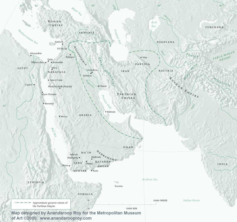
West Asia in the Year One
Summary
This map shows West Asia in 1 AD, including the approximate boundary of the Parthian Empire at its greatest extent.
Source
The map was originally designed for the exhibition, “The Year One: Art of the Ancient World East and West”, Metropolitan Museum of Art, New York, June 2000.
Copyright
© 2000 Anandaroop Roy
Used here with the kind permission of Anandaroop Roy (June 29, 2007).
Series
This map is one of a series:
- Asia in the Year One.jpg
- West Asia in the Year One.jpg
- The Roman Empire in the Year One.jpg