
Caption
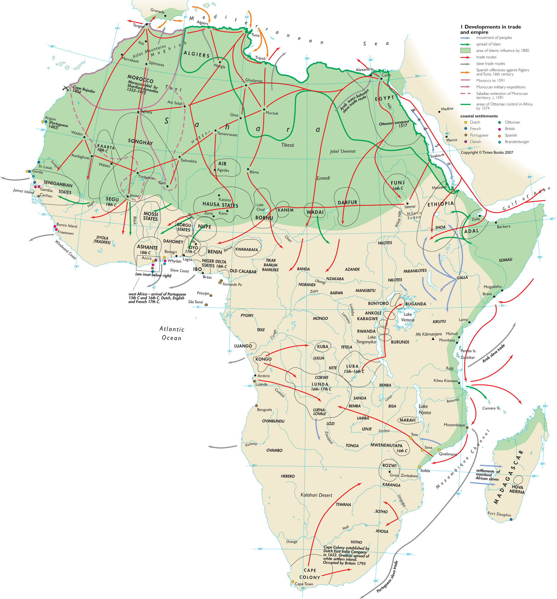
Developments in trade and empire, 1500-1800
Summary
This map of Africa provides an overview of the history of trade and empire
in Africa in the three hundred years before 1800.
The map shows areas of Ottoman control in Africa by 1574, the location
of Ottoman and European coastal settlements (Netherlands, France,
Portugal, Denmark, Britain, Spain, Brandenburg), and the extent of
Islamic influence by 1800.
The map also gives the locations and dates of Ottoman conquests, and
shows the expansion of Moroccan territory under [[wikipedia:Ahmad I
al-Mansur Saadi|]].
Arrows on the map indicate slave trade routes; other trade routes; the movement
of peoples; the extension of Islamic influence; Moroccan military expeditions;
and the Spanish offensives against Algiers and Tunis.
The areas covered by the following African states are indicated:
- Morocco (Sharifian dynasties)
- Senegambian states
- Niger Delta states
- Hausa states
- Mossi states
Copyright status
Copyright © Times Books 2007
Reproduced from The Times Complete History of the World by permission of HarperCollins Publishers Ltd.
Licensing
All rights reserved
Source
The Times Complete History of the World (2007), p. 182-3.