
Caption
Population Distribution and Indigenous Peoples in the Arctic, 2002
Summary
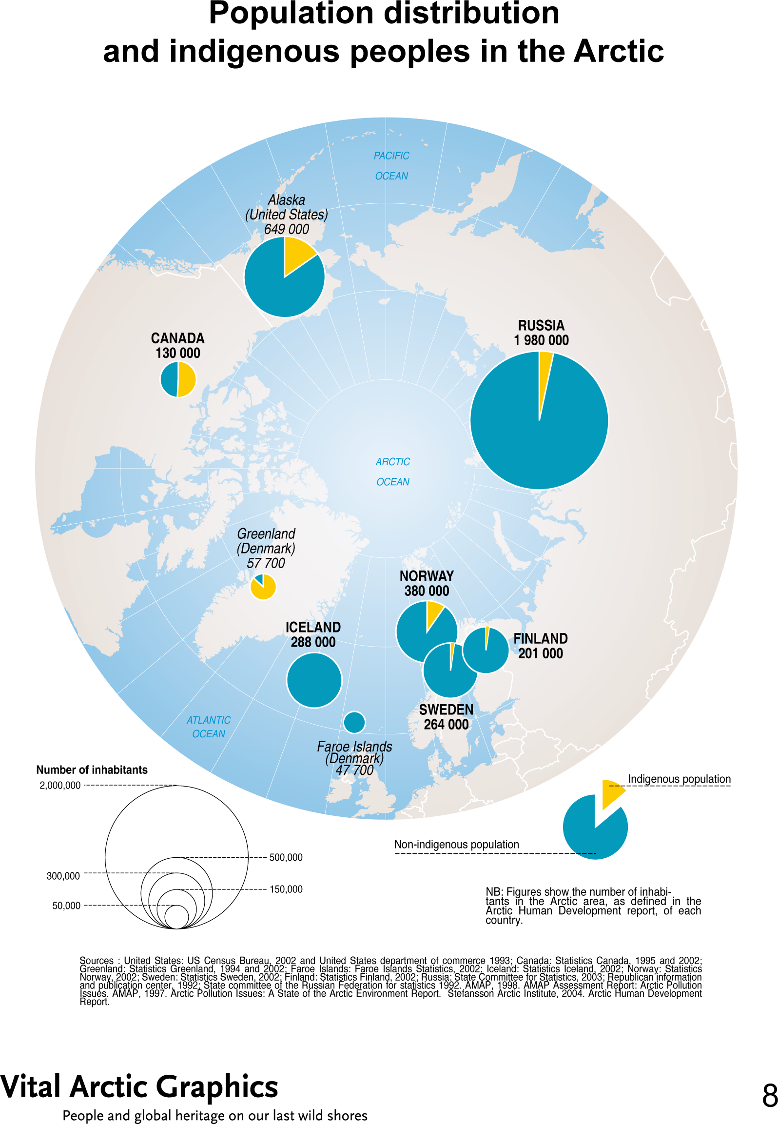
This map shows the Arctic population, spanning several continents, consisting of about four million inhabitants, a third of whom are indigenous and still rely mainly on their natural resources.
Additionally, each circle, which is proportional to the size of population per region, is a pie chart indicating what percent of each regional population is indigenous.
Source
United Nations Environment Programme / GRID-Arendal[1]
Cartographer/Designer: Hugo Ahlenius, UNEP/GRID-Arendal
Primary sources:
- United States: US Census Bureau, 2002 and United States department of commerce 1993
- Canada: Statistics Canada, 1995 and 2002
- Greenland: Statistics Greenland, 1994 and 2002
- Faroe Islands: Faroe Islands Statistics, 2002
- Iceland: Statistics Iceland, 2002
- Norway: Statistics Norway, 2002
- Sweden: Statistics Sweden, 2002
- Finland: Statistics Finland, 2002
- Russia: State Committee for Statistics, 2003
- Republican information and publication center, 1992
- State committee of the Russian Federation for statistics 1992
- AMAP, 1998. AMAP Assessment Report: Arctic Pollution Issues
- AMAP, 1997. Arctic Pollution Issues: A State of the Arctic Environment Report
- Stefansson Arctic Institute, 2004. Arctic Human Development Report.
Copyright
© 2006 UNEP / GRID-Arendal
Licensing
For use constraints, see [2] or [3].
Series
This map is one in a series For a listing with flyovers, see Series:UNEP / GRID-Arendal.