
Caption
Human Impact in Latin America, 2001
Summary
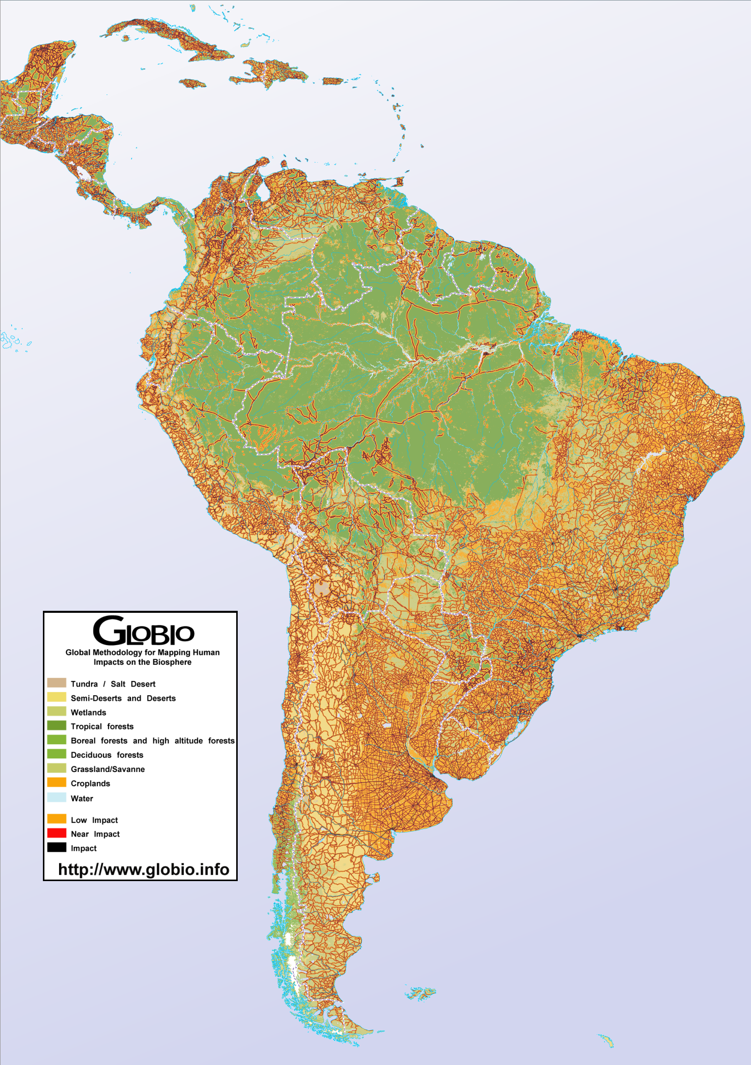
This map shows GLOBIO estimates of human impact in Latin America and the Caribbean. The estimates, which use the location of infrastructure (such as roads, dams, and utilities) as an indicator, were performed in November 2001 using the GLOBIO methodology in effect at that time, and the DCW as data source, together with the GLCCv2 landcover data. The basis for the classification of human impact is obscure.
Land cover categories have been used for the non-impacted (wilderness) areas on the map:
- tundra or salt desert
- semi-deserts and deserts
- wetlands
- tropical forests
- boreal forests and high altitude forests
- deciduous forests
- grasslands (savanna)
- croplands
- water
Source
United Nations Environment Programme / GRID-Arendal[1]
Cartographer/Designer: Torstein Olsen and Einar Lieng, Statens Kartverk (for UNEP/GRID-Arendal)
Primary Source:
- Analysis performed in November 2001, using the GLOBIO methodology as of November 2001, and the DCW (ESRI/NIMA) as data source, together with the GLCCv2 (USGS) land cover. Land cover classifications has been used for the non-impacted (wilderness) areas in the map graphics.
Copyright
© 2006 UNEP / GRID-Arendal
Licensing
For use constraints, see [2].
Series
This map is one in a series For a listing with flyovers, see Series:UNEP / GRID-Arendal.