Caption
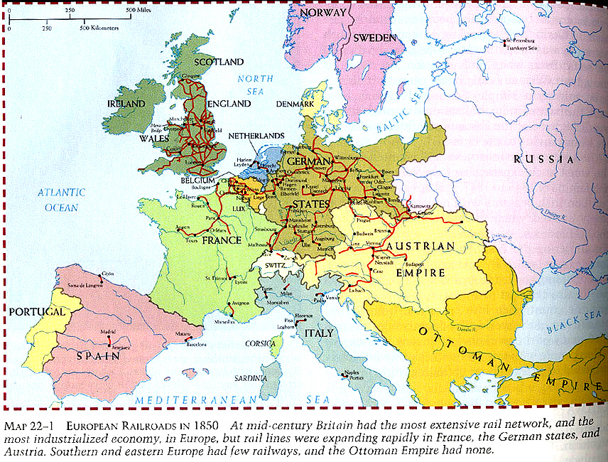
European Railroads in 1850
Summary
Map shows railways in Europe during the 19th century.
Source
Donald Kagan et al. The Western Heritage Since 1300. (p. 746)
Prentice Hall [Pearson]
Copyright
© 2004 Prentice Hall [Pearson]

European Railroads in 1850
Map shows railways in Europe during the 19th century.
Donald Kagan et al. The Western Heritage Since 1300. (p. 746)
Prentice Hall [Pearson]
© 2004 Prentice Hall [Pearson]