
Caption
Crushed by War since 1990
Summary
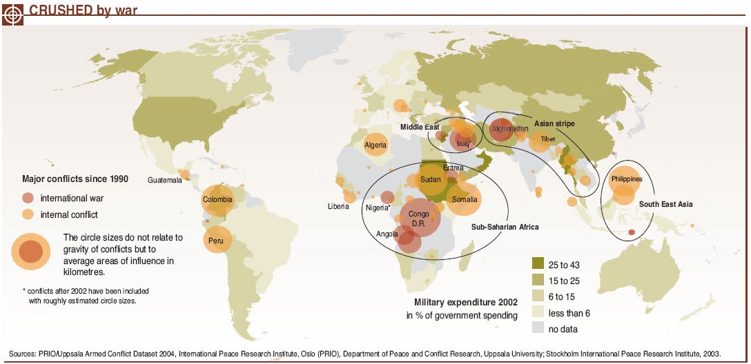
This map shows the most important conflict areas since 1990, depicting internal conflicts and international wars. The width of the circles relates to the average areas of influence in kilometers.
The map also indicates the average military expenditures faced by each country’s government in 2002, providing ranges.
Source
United Nations Environment Programme / GRID-Arendal[1]
Cartographer/Designer: Emmanuelle Bournay, UNEP/GRID-Arendal
Primary Source:
- PRIO/Uppsala Armed Conflict Dataset 2004, International Peace Research Institute, Oslo (PRIO), Department of Peace and Conflict Research, Uppsala University
- Stockholm International Peace Research Institute, 2003
Copyright
© 2006 UNEP / GRID-Arendal
Licensing
Used with permission.
For use constraints, see [2].
Series
This map is one in a series For a listing with flyovers, see Series:UNEP / GRID-Arendal.