
Caption
Chinese exploration by c. 1450
Summary
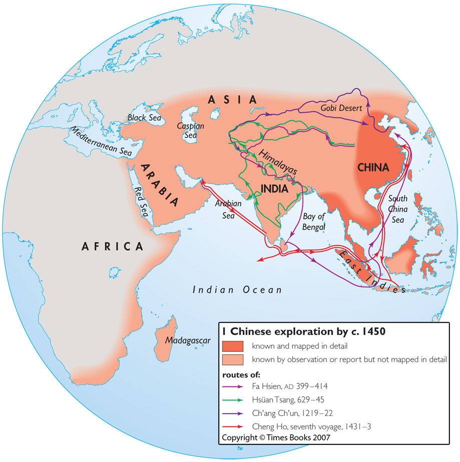
This map is one in a series of maps in the source book illustrating
the boundaries of geographical knowledge of different civilizations at
the time of Columbus’s voyage to the Americas.
The map distinguishes between the areas which were mapped in detail and
those which were known by observation but not mapped in detail, and identifies the routes of:
- Faxian (Wade-Giles: Fa Hsien), 399-414
- Xuanzang (Wade-Giles: Hsüan Tsang), 629-645
- Qiu Chuji (Taoist name: Changchun (Wade Giles: Ch’ang Ch’un)), 1219-1222
- Seventh voyage of Zheng He (Wade Giles: Cheng Ho), 1431-1433
Copyright status
Copyright © Times Books 2007
Reproduced from The Times Complete History of the World by permission of HarperCollins Publishers Ltd.
Licensing
All rights reserved
Source
The Times Complete History of the World (2007), p. 170.
