
Caption
Child Labor
Summary
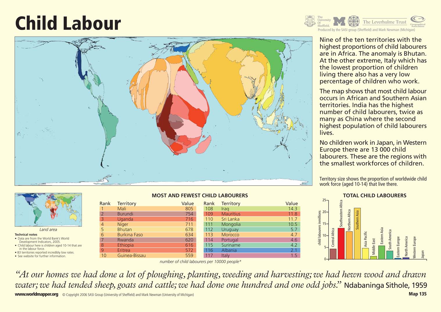
This “Worldmapper” map shows the prevalence of child labor, or children aged 10-14 in the labor force, by country. Territory size shows the proportion of the worldwide child work force from each particular country. Most child labor occurs in African and Southern Asian territories. Although African nations have the most child laborers per capita, regions like India with large populations of child laborers are shown larger on the map. 83 territories reported incredibly low rates of child labor.
The map is accompanied by two tables that show ranked lists of the ten countries with the most and fewest child laborers per 10,000 people. There is also a bar graph that shows the number of child laborers in millions by region.
Copyright status
© Copyright 2006 SASI Group (University of Sheffield) and Mark Newman (University of Michigan)
Used on QED by permission.
Licensing
All rights reserved