Skip to main content
Mapping Globalization
Menu
Skip to content
Data and Analysis
NetMap Studies of World Trade
Network Analysis
Maps
Narratives
Empires
Alexander the Great
Byzantine Empire
Invasion of the Goths
Migration
Asia
Eurasia
Europe
The Genetics of Prehistoric Migration
Indoeuropeans
Out of Africa
Menu
Skip to content
Contact
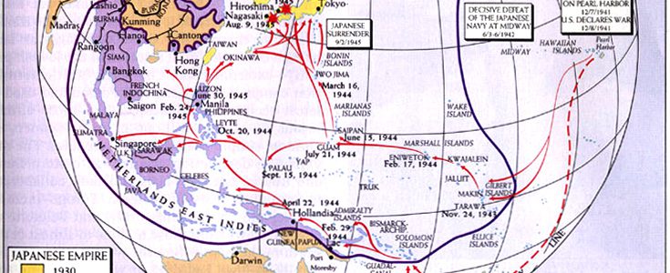
World War II in the Pacific
World Time and Foreign Exchange, 1986
World Soil Resources, 1993
World Route Chart, 1970
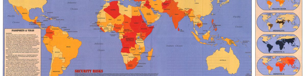
World Risk Map, 1999
World Religions c. 1970
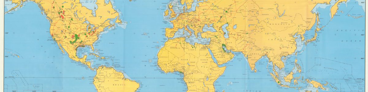
World Oil and Gas Activity Map, 1984
World Grains, 2005
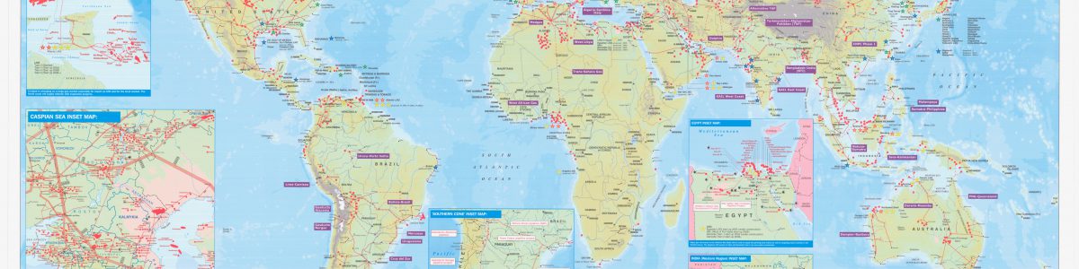
World Gas Map, 2001
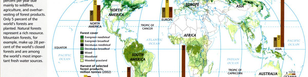
World Forests, 2005
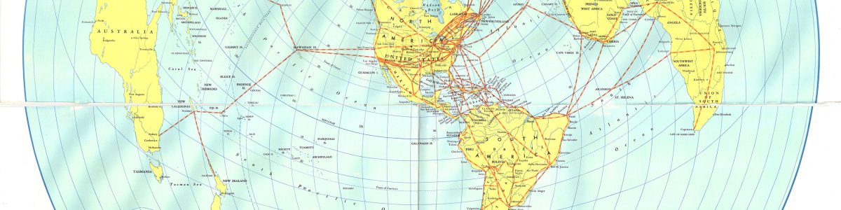
World Flights Map, 1939
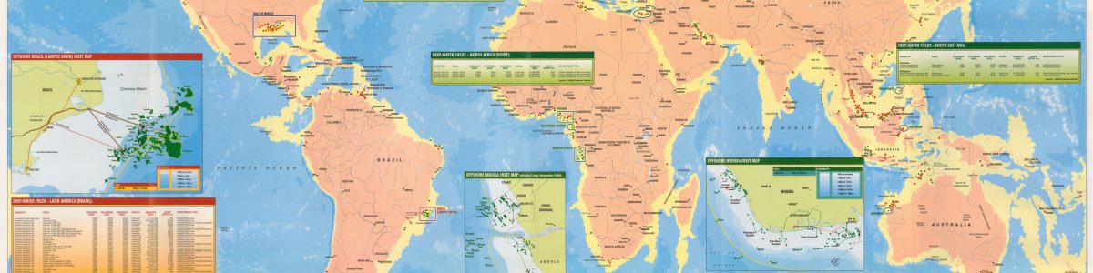
World Deepwater Developments Map, 2001
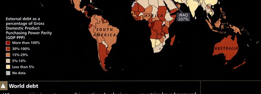
World Debt, 2005
World Climates, 1984
World Air Transportation – Principal Routes of Scheduled Commercial Airlines, 1951
World Air Routes for United States Flag Carriers, 1946
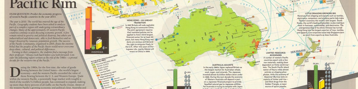
Western Pacific Rim, 1989
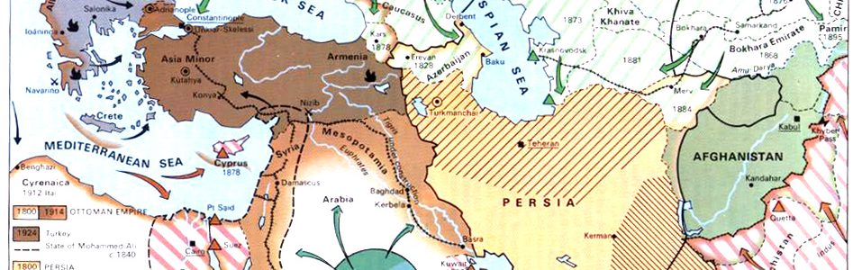
Western Asia in 19th Century
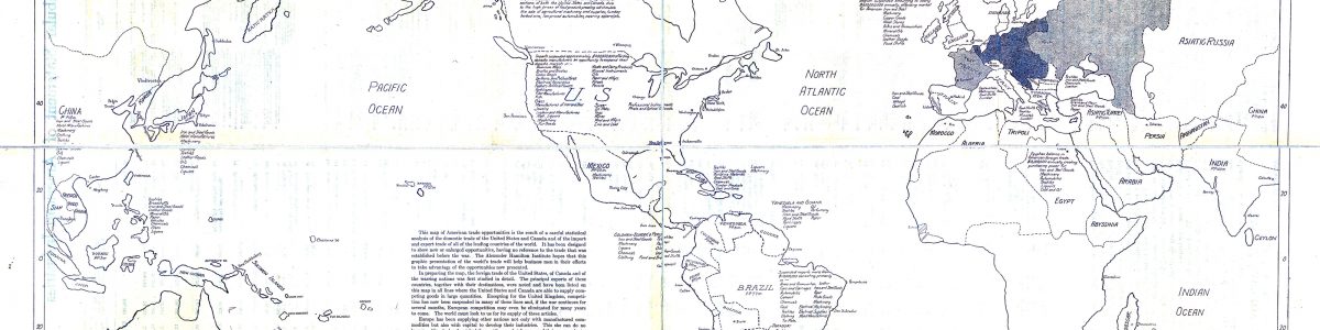
War Map of American Trade Opportunities, 1914
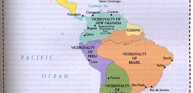
Viceroyalties in Latin America in 1780
USSR Foreign Policy 1967-75
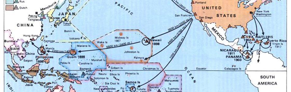
U.S. Expansionist Policies from 1867
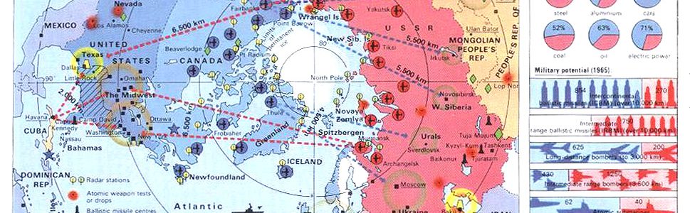
USA and USSR – the two Major Powers, c. 1960
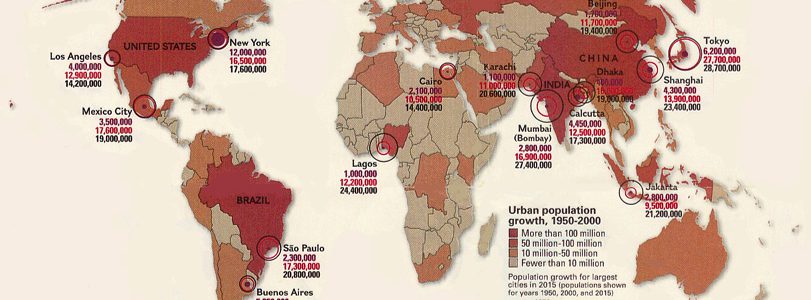
Urban Population Growth, 1950-2000
Two Trading Empires – Venice and the Hansa
Transport of Indian Workers in the Nineteenth Century
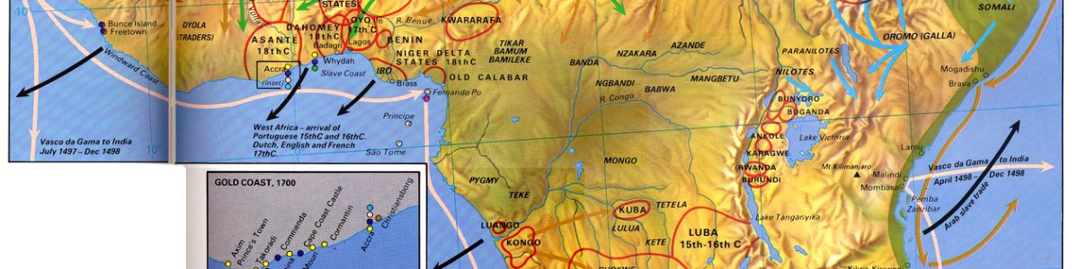
Trade, Slavery and Warfare in Africa 1450 – 1870
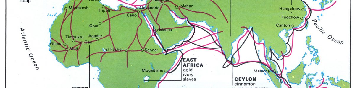
Trade Sites and Goods in the 15th Century
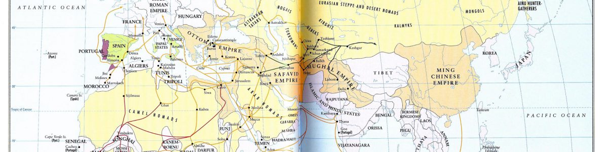
Trade Routes and Empires, 1500
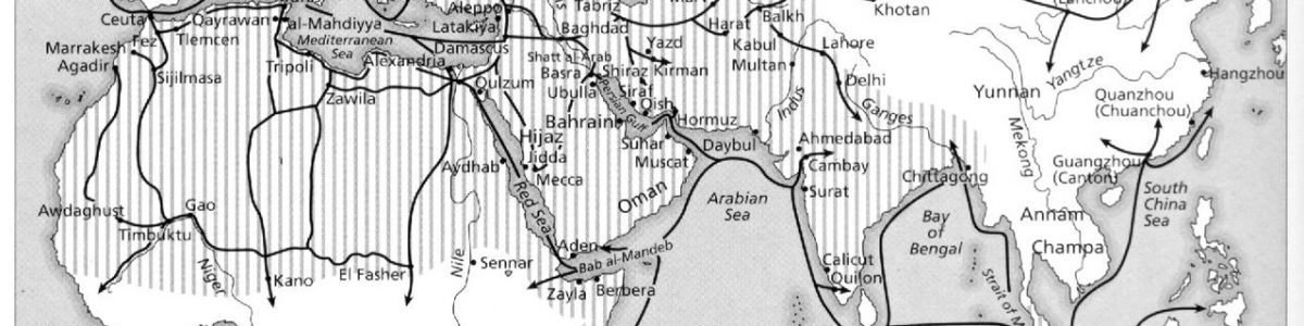
Trade Routes and Centres 600-1500
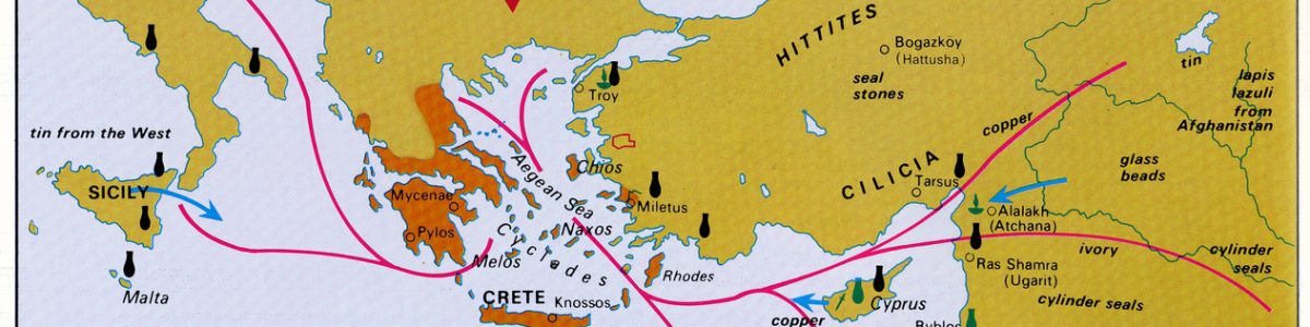
Trade in the Mycenaean World
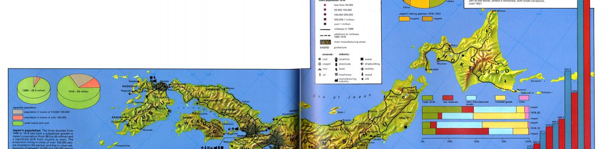
Trade in Japan 19th – 20th centuries
Trade in Asia 1 to 300 CE
Trade in Africa and Asia
Trade and Artistic Influence in Europe, 1000-1200
Post navigation
Previous
1
2
3
4
…
25
Next