
Caption
Black Sea Water Indicators, 1988 to 2000
Summary
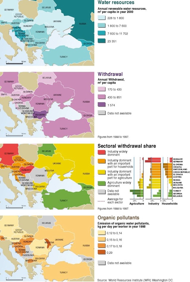
This set of four maps shows four water resource indicators for the Black Sea region: annual renewable water resources, annual withdrawal (or water use), sectoral withdrawal share (industry, households, and agriculture), and emission of organic water pollutants (kg per day per worker).
An inset chart shows sectoral withrdrawal shares for Hungary, Germany, Slovenia, Croatia, Switzerland, Czech Republic, Slovakia, Austria, Russia, Ukraine, Moldova, Bulgaria, Turkey, Georgia, and Belarus.
Source
United Nations Environment Programme / GRID-Arendal[1]
Cartographer/Designer: Philippe Rekacewicz, UNEP/GRID-Arendal
Primary Source:
- World Resources Institute (WRI) Washington DC.
Copyright
© 2006 UNEP / GRID-Arendal
Licensing
For use constraints, see [2].
Series
This map is one in a series For a listing with flyovers, see Series:UNEP / GRID-Arendal.